Tham Heup


One of the famous tunnel-caves in Khammouane
Acces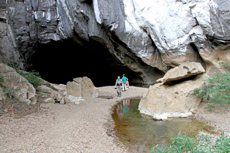
Tham Heup opens on the left bank side of the Nam Hin Boun, two km east of Ban Nakhok, a small village not far from Ban Thonglom at the opening of the magnificent Nam Hin Boun gorges in the Mekong plain. The flow of the Nam Hin Boun, increased by the waters coming from the hydro-electric dam on the Nam Theun I in Ban Na Hin, a few kilometers upstream, forces to cross the river on a pirogue.
A hundred meters before the porch, cross a small river with transparent waters bordered by a high cliff.
Coordinates:
N 18 ° 00 00.5 E 104 26 13.2 Alt. 151 m
Topographic map at 1/50000: Ban Bok (and Ban Na Hin).
Get all the required Lao maps here
Photo 1 - Tham Heup entrance (february 2012 - © B. Galibert)

Historique
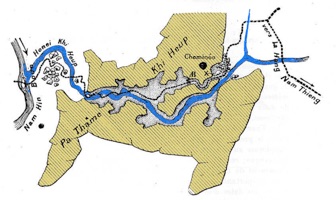
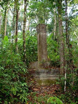
Tham Heup, the "cave where one hides" has been known at all times and used centuries ago by Lao people. It offers a connection between the Nam Hin Boun valley and a polje otherwise almost inaccessible, in which hides the Na Heup village (also named Ban Noi Nakhok). Some facilities - wooden walkways, carved steps - help the villagers progression and avoid swimming in the deepest water passageways. The old age of the conquest of Tham Heup is attested by the ruins of an ancient city lost in the middle of the polje. A legend says that in the XVIIIth century, a Thai army, in pursuit of Lao villagers hiding in the cave, tried to shut the cave and lit a large fire at the entrance to smoke the people inside. An attempt doomed to failure ...
In 1902, the cave was traversed by Paul Macey, who made later an enthusiastic account of this visit, related in the Histoiry section of this website. One can remember that the crossing is easy enough that Macey took his horse through the cave.
Proposed as an "adventure" path by several agencies, it is regularly visited by tourists.

Description
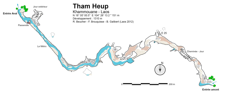
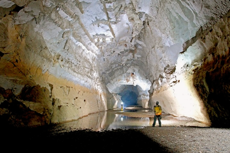
The entrance porch is ”only” 25 m wide and 15 m high, dimensions rather modest for Laos. A stretch of water occupies the entire passage. After immersion to the waist, a deep reach is crossed on a wooden bridge. Shortly after daylight is detected from an escarpment on the left (right bank). The river which depth rarely exceeds 50 cm plunges to the southeast, in a 20 m large gallery, straight and nearly 400 m long. Progression is mainly on beaches of sand and peebles.
At the end of the straight portion, a bend orients the cavity to the east. At this point the section of the gallery is, on the right bank, a bench rock dissected by a splendid diaclasis occupied by a tributary. Two bridges and a bamboo ladder help regain a foothold on the bank.
The 400 m subway tunnel (february 2012 - B. © Galibert)
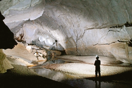
No wonder Macey could bring his horse ! (february 2012 - © B. Galibert)
120 m farther, a small impenetrable water feed is found and soon after a superb duct on the ceiling is leading north, but a 25/30 m climb blocks the access.
The gallery turns back to the southeast. The floor is made of tamped clay and blocks. 100 m further, the base of a large boulder choke is reached where a ray of light falls from a shaft in the ceiling. On the left, a narrow passage - still 1 to 2 m wide ! - 60 m long avoids the climbing and descent of the boulder choke. The exit is 150 m farther and natural daylight already lit the passage.
At a bend in the tunnel shortly before the front porch outlet, the water circulation and the river are rejoin. We emerge finally in the polje of Ban Na Heup after a 1200 m underground hike.
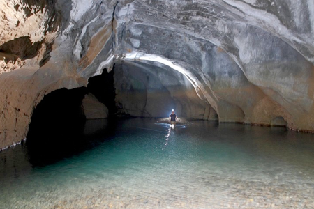
The turquoise waters of Tham Heup are an invitation for swimming
(february 2012 - B. © Galibert)
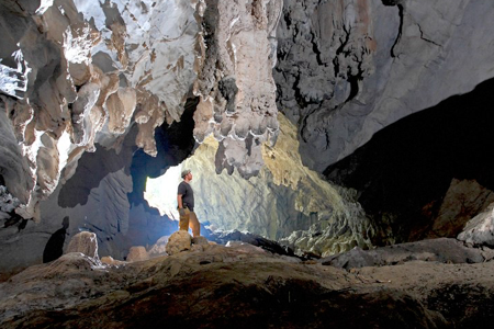
Last metres before the upstream entrance (february 2012 - © B. Galibert)