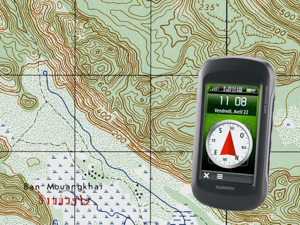
Caving in Laos - Know where you are !


Map dots : a new tool for Laos explorers
Fortunately, old 1:50000 maps are still available. They were created by the french and US cartography services 50 years ago and date back to the Vietnam war era. Still extremely useful if you plan to travel in the remote parts of the country since the landscape has not changed significantly yet.
These maps are in the public domain. They can be obtained from three websites : the University of Florida Libraries, the University of Texas Libraries (hosting the Perry-Castaneda Library Map Collection) and the Vietnam Center and Archive also at Texas University. The University of Florida has a smart system to get zoomed portions of the original maps, but navigation is a pain. Navigation is easier with the Vietnam Center and Archive, but unfortunately, is restricted to Vietnam...
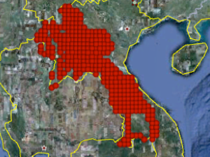
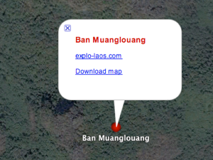
This is why a dedicated tool has been developed to help find rapidly the right map for a given area. This easy access to the Laos digital topographic maps collection is based on Google Earth. When opened with Google Earth, the Map dots Laos.kmz file creates a series of red dots, centered on each of the 300+ maps, which cover most of the Lao PDR. A mouse click on any of these dots opens a balloon where you can select "Download map" to retrieve the map as a jpeg file. Since each file weights 6-20 Mo, the download may take a while, depending on your connection speed. Be patient. With a proper DSL connection, the operation takes less than 20 s.
Now, you have access to the most complete digital map collection of Laos
In case of difficulties, send us an email using the "Contact" page.
And in case of success, send us an email anyway ! ;-)
If by chance, you possess one of the lacking maps, you can help make this collection fully complete. Contact us and we'll provide a link to upload a copy of this most desired map. Thanks for your help.
10 décembre 2011